In December 2015, Major J W Swanson and Corporal T McWhirter from the Northern Ireland Garrison Support Unit (NIGSU) began the extensive planning process for their first overseas Adventure Training expedition to Nepal. The culmination of this planning was Expedition Finn Himalaya, which took place from 15th September 2017 to 7th October 2017.
Adventure training is open to all personnel regardless of length of service, trade or rank and provides ample opportunity for personal development. Adventure training can to some degree replicate the pressures of operations where personnel are expected to perform in potentially dangerous environments with little or no prior exposure and thus Adventure Training is ideal in preparing personnel for deployment.
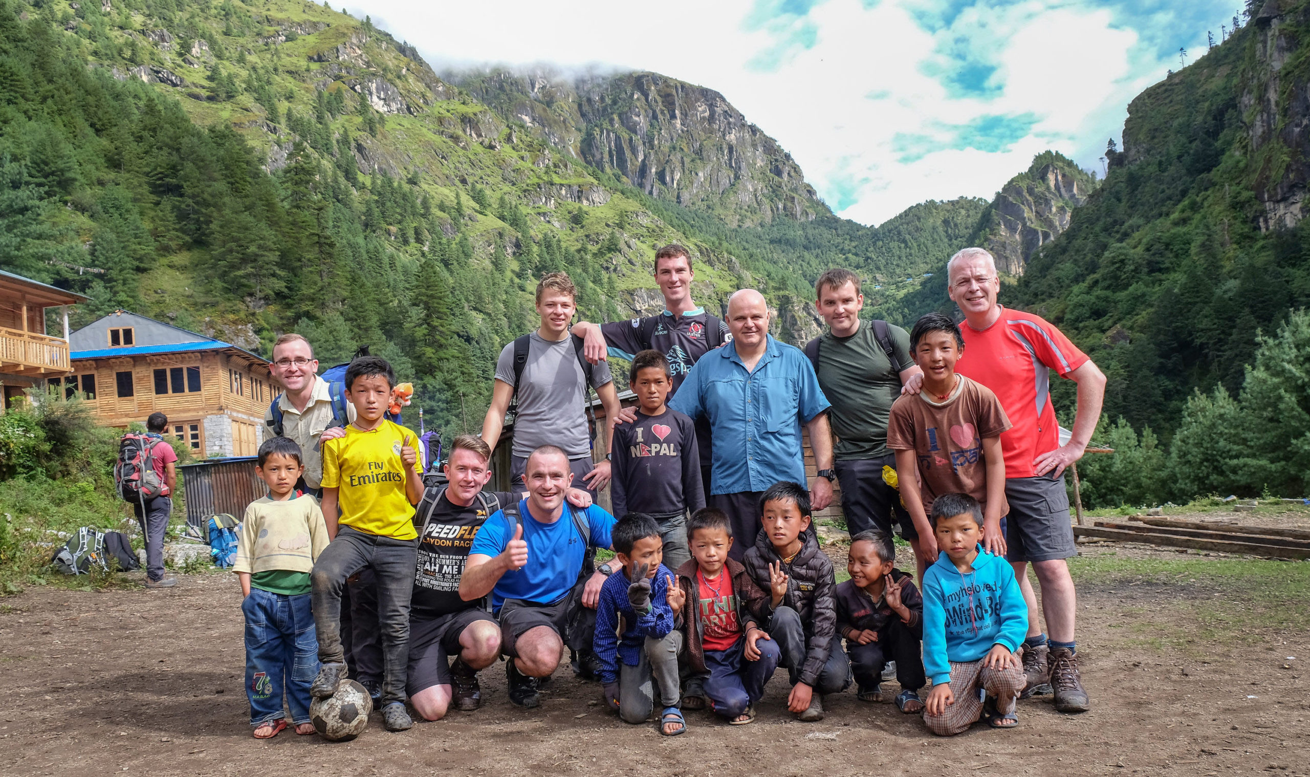
The team of fourteen personnel came from a wide cross section of the British Army, with thirteen full time and one reserve member on the team, representing NIGSU. The team was predominately Royal Logistic Corps cap badged (trades represented Drivers, Chefs, Postal & Courier and an Ammo Tech) but also represented were soldiers from the Royal Engineers (Geographic) , Royal Signals (Technician), Adjutant General’s Corps (RAO) and Royal Irish Regiment (Band and a member of the Guard Force) . Ages ranged from the youngest at 20 years old to the oldest at 54 years old ! In preparation for the main expedition, the team completed two training weeks within the UK, trekking on Hadrian’s Wall in Northumberland and completing part of the West Highland Way in Scotland, as well as summiting Ben Nevis. The majority of personnel also completed their Summer Mountain Foundation (SMF) phase during these training weeks.
The main objective on the Nepal trip was to complete fourteen days of trekking in the Himalayas and to reach Everest Base Camp. Fourteen days is the minimum timeframe for a trek from Lukla to Everest Base Camp and back, otherwise you would be exposing yourself to the risks of Acute Mountain Sickness (AMS).
Expedition Finn Himalaya
With final preparations completed, the team of fourteen set off from NIGSU Headquarters on 15th September. After a five hour flight to Abu Dhabi, followed by a further four hour flight the group finally arrived in Kathmandu’s Tribhuvan International Airport. After a short transfer through the bustling and colourful city streets of Kathmandu we arrived at the British Gurkhas Nepal Camp, our base for the next day. Personal admin completed we had time to enjoy our first taste of Nepalese food – goat curry!
The following morning allowed time for us to pack (and repack) our ‘mountain bags’, which due to weight restrictions on the aircraft flying in to Tenzing-Hillary Airport this bag combined with our day packs could weigh no more than 14kg combined weight – careful planning and ruthless packing is needed. The afternoon allowed for us to have the chance to visit a few local shops in Kathmandu and try our haggling skills before returning to camp to get a decent night’s sleep prior to heading to the foothills of the Himalaya to begin the main part of our Adventure Training.
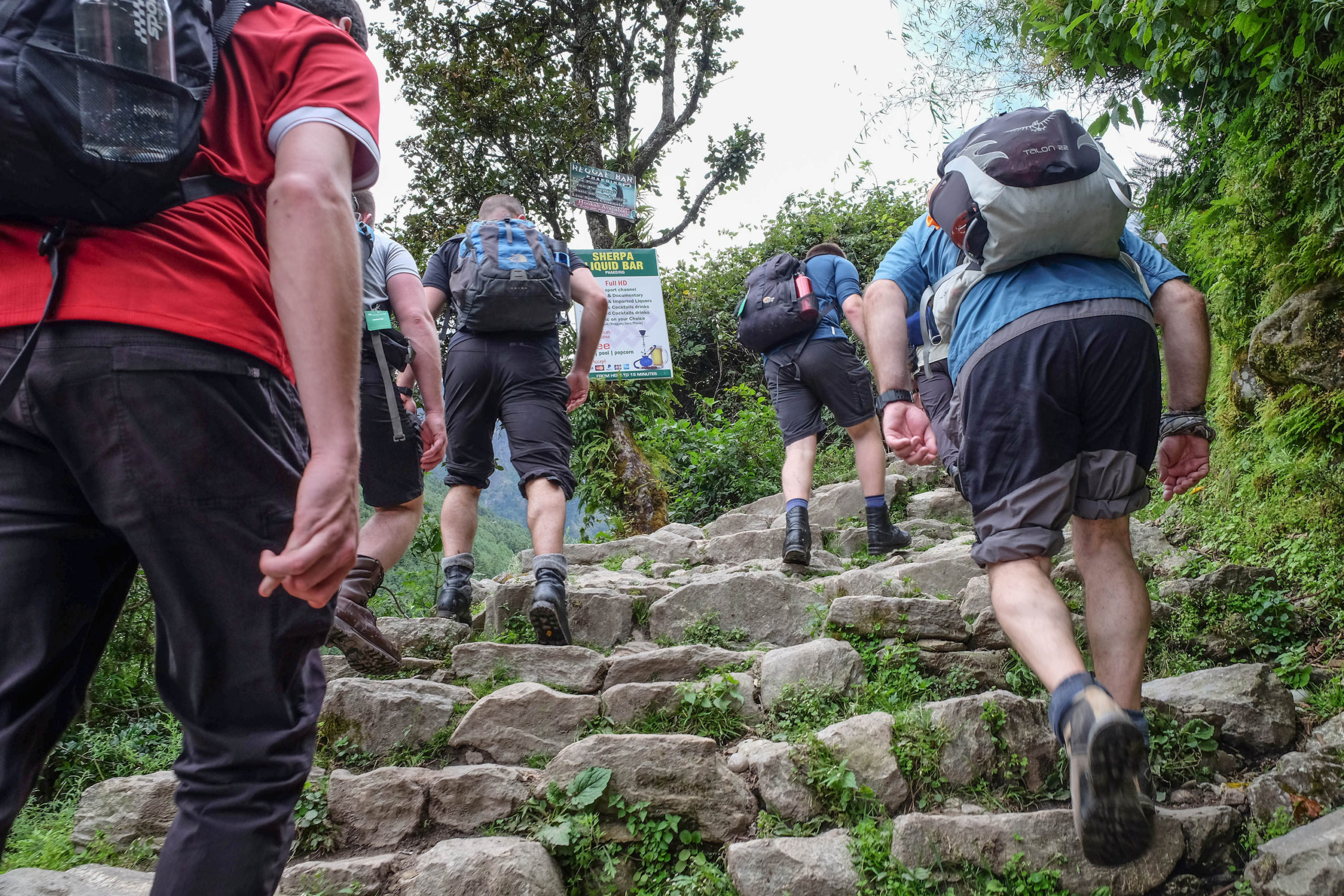
Day 1 Kathmandu to Lukla to Phakding
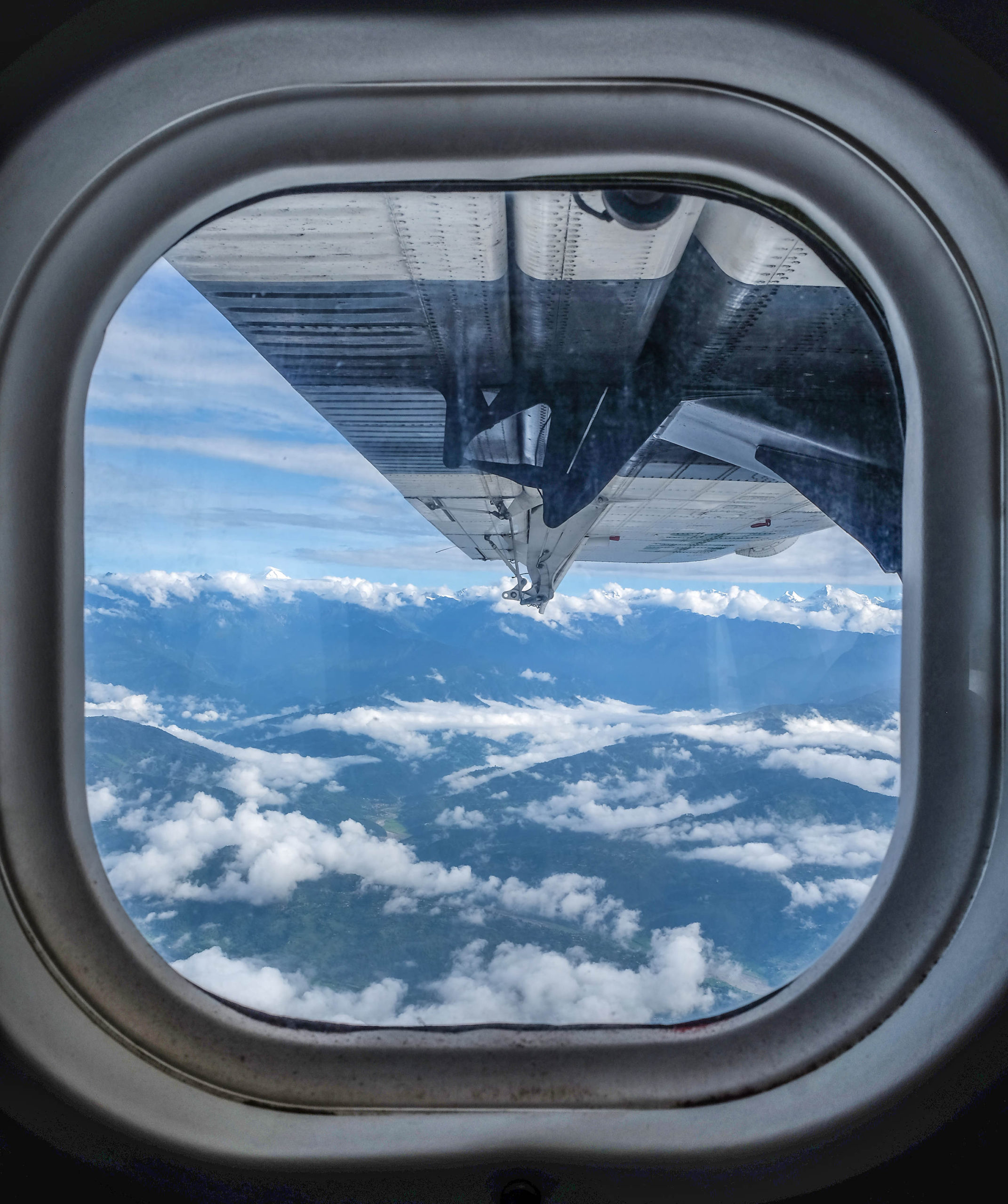
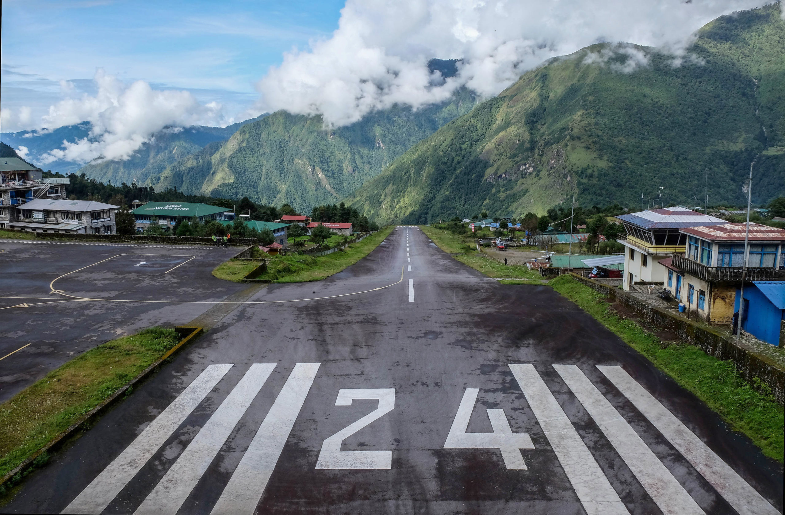
An early morning flight out of Kathmandu International Airport allowed us some spectacular views of the surrounding area and countryside. The flight itself is a unique experience, travelling on a Twin Otter aircraft, we were able to view the cockpit throughout the trip and the cabin crew handed around the cotton wool as makeshift ear defenders! After half an hour we began our approach to the airstrip at Lukla – at 2800m, with a very short runway which slopes sharply upwards (and known as the second most dangerous airport in the world), this busy airstrip can serve up to 80 flights per day at the height of trekking season.
After a short break in Lukla, to take on board water and complete our ‘Trekkers’ Information Management System (TIMS)’ cards (ie our trekking passports), we finally set off on the first leg of our trek. Leaving Lukla behind, we were soon passing through local villages and lush mountain forest scenery on the three hour trek to Phakding. Although having started the trek in Lukla (2840m) we had descended to Phakding (2610m), and therefore had some time to allow for the first important steps in the process of adjusting to the change in altitude in preparation for the more significant changes we would encounter in the coming days.
Day 2 Phakding to Namche Bazaar
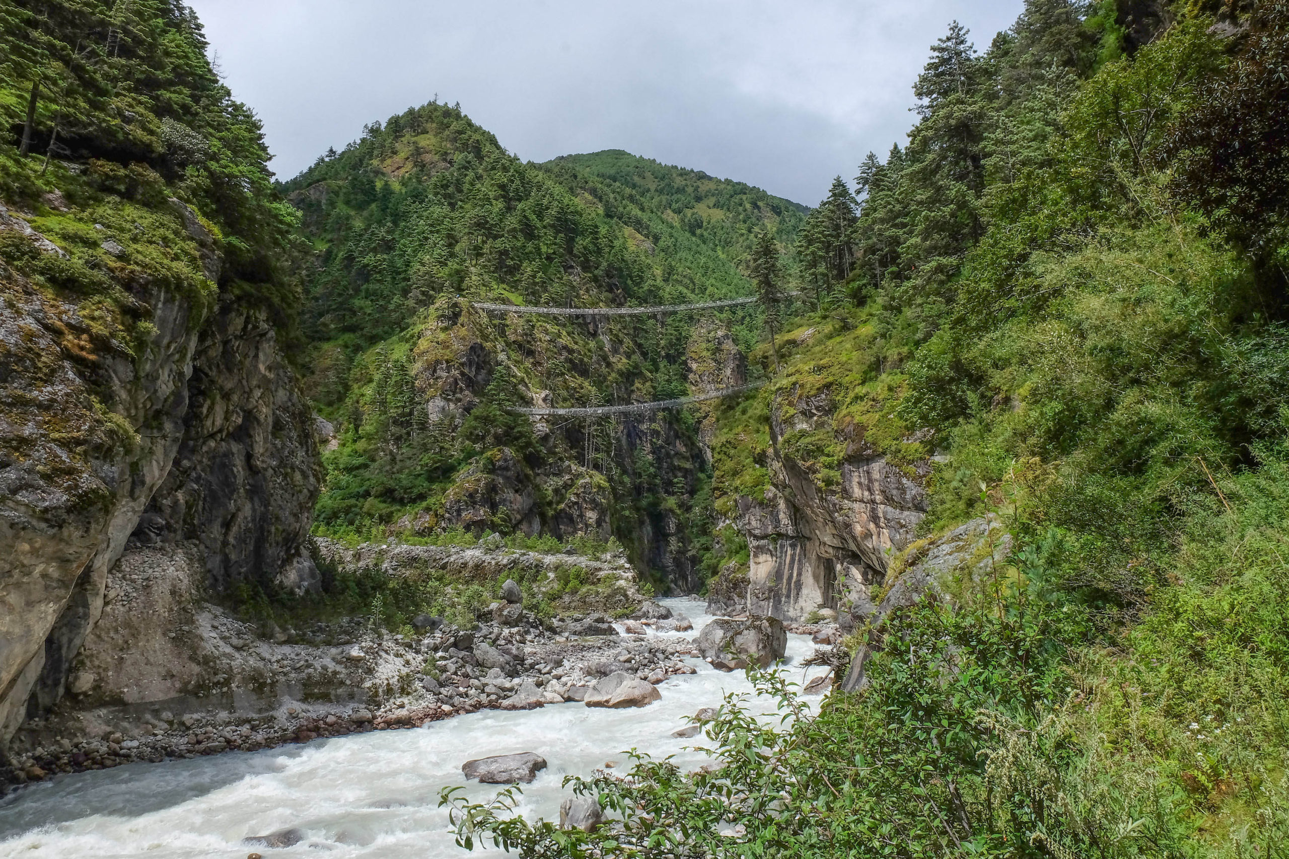
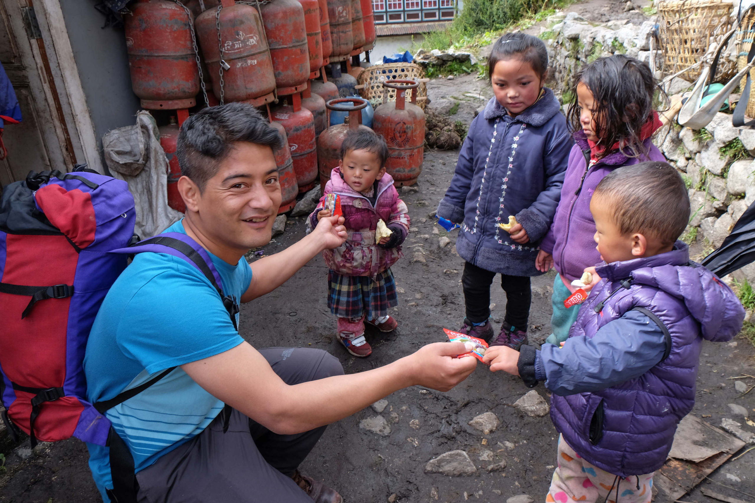
Leaving Phakding behind, we set off on the next stage of our trek, which saw us walking alongside a river through the Dudh Kosi Valley as we headed north. Again, we passed through a number of local villages and even had enough energy to join in a football match with a group of local children. As we continued, the trail rose and fell as we passed by many pine trees and waterfalls. After a number of hours trekking we reached the entrance to the Sagarmatha National Park, where we presented our TIMS cards before passing through a stupa-shaped gateway (a stupa is a Buddhist shrine). From here the trek dropped further into the valley, crossing back and forth high across the river on the wire suspension bridges. After a welcome break for lunch in Jorsale, we passed through an army checkpoint at the edge of town, before continuing over gravel and boulders at the side of the river before returning to the forest. We crossed one final suspension bridge – at around 150m long, and over 150m above the river, this is either the most spectacular or terrifying crossing yet! From here the climb to Namche is a never-ending upwards zigzag through the forest and after two endless hours we were glad to reach another checkpoint and a few moments to catch our breath. After a total of 16km, an ascent of 1000m, and a final climb we eventually reached Namche Bazaar at 3440m – the first point in our trek where we are considered to be at high altitude and need to be very aware of the signs and symptoms of AMS.
Day 3 Namche Bazaar
Today is an acclimatisation day in Namche – these days are essential to allow our bodies to adjust to the change in altitude and the lower levels of oxygen in the air. An acclimatisation day is by no means a ‘rest day’. Instead, we leave the town behind and climb a further 400m up the mountainside above Namche to the ‘Everest View Sherpa Lodge’ – sadly the weather is rather cloudy and are unable to get our first glimpse of Everest. Following the mantra of ‘walk high and sleep low’ we remain here for over an hour to allow our bodies to continue to acclimatise. On the steep climb back down to Namche we visit the Sagamartha National Park Centre, which gives us an insight into the history of the Sherpa people, the local wildlife and plant life, as well as the history of first summit of Everest by Sir Edmund Hillary and Tenzing Norgay in 1953. In the afternoon there is time to prep our kit for the next day, as well as climb through the town.
Day 4 Namche Bazaar to Tengboche
Having been very fortunate so far with the weather, we awoke today to a steady downpour. So donned in waterproofs we climbed out of Namche to reach the start of the main climb for the day. At this point we all turned the Tibetan Prayer Wheel (in Buddhist culture the turning of the wheel sends prayers into the air) in the hope that the rain would clear and we would have a good day. The trek we followed today was on a route that contoured around the side of the mountains, so for the main part remained reasonably flat with only a few relatively small climbs and descents. However, the persistent rain made the path muddy and slippy and with a sheer drop on one side of the path walking poles became a valuable asset on this stage of the trek. As we progressed along the path the weather meant that we were unable to enjoy any long-range views, but in close proximity we were able to see juniper trees, alpine flowers and endless rhododendron trees. The rhododendron tree is originally from Nepal, with thirty-two different native varieties and the red flower is the national flower of Nepal – early explorers brought the plant back to the UK to be cultivated into the plant that many of us have in our gardens. The trek continued steeply downhill and eventually the weather began to clear slightly as we reached Phunki Thenga (at 3250m it’s lower than our starting point today). Crossing the long suspension bridge across the river we began the inevitable climb towards our destination. The climb was slow and steady, zigzagging up the mountainside as we gained a height of 600m. On the way we passed the now familiar sight of groups of yaks transporting kit and equipment – and by now we all know that yak drill is to stand to the ‘uphill’ side of the mountain to allow the yaks to pass below you so that you don’t accidentally get knocked off the mountain side by one of these animals!
After an hour of steady uphill a final push saw us arrive at Tengboche, our destination for the evening at a height of 3,856m, and home to the largest Buddhist Monastery and Stupa in the region. We were fortunate enough to visit the monastery as a number of the monks were in the middle of a service of worship and prayers. Shortly after returning from the monastery, a number of the monks threw down the gauntlet and challenged the guys to a football match – where else would you get such a thing?!
Day 5 Tengboche to Dingboche
Waking this morning we were treated to clear views of the many surrounding snow capped mountains all around and in the distance. Setting off, we once again dropped down through forests of rhododendron, to the small wooden bridge over the Imja Khola River before climbing upwards from the river through the many small villages along this route. Leaving the village of Pangboche behind we begin to climb above the tree line with the scenery changing to alpine meadows and glacial boulders. With clear weather the views were spectacular and along the trek today we catch our first fleeting glances of the summit of Everest in the distance, together with many of the surrounding peaks such as Island Peak and Lhotse. After a steady climb all day we finally reach Dingboche (4400m).
Day 6 Dingboche
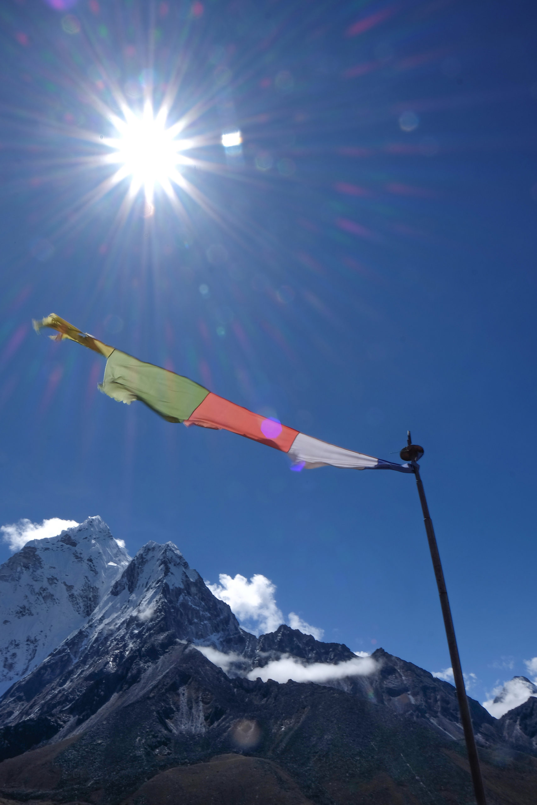
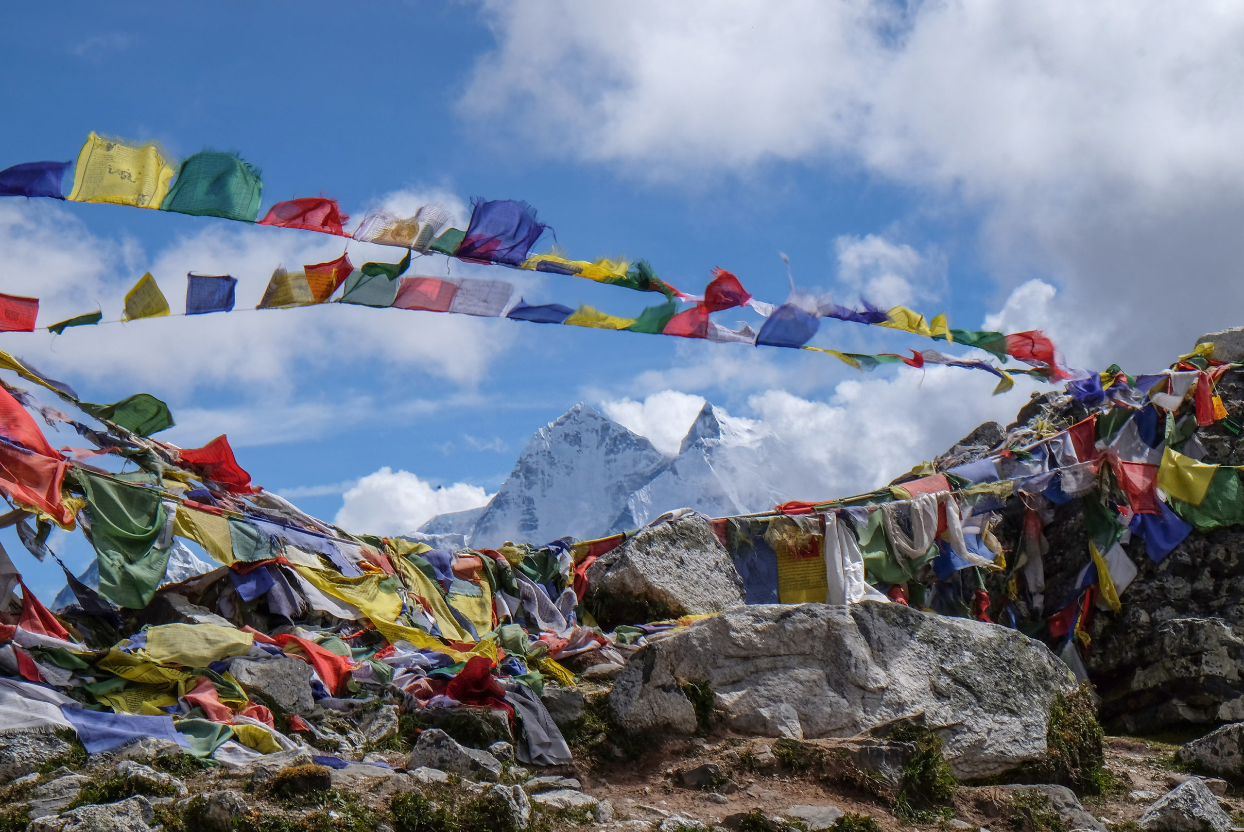
Today is another essential acclimatisation day, and at this point a number of the group are showing some of the typical signs of being at high altitude such as dizziness, sore heads, lack of appetite. So heading out of Dingboche we climb slowly on the ridge north of the town, past the numerous strings of prayer flags to a viewpoint at 4800m – it is very obvious when trekking at this altitude that there is considerably less oxygen in the air and that catching your breath takes much more effort. The weather is good and we are able to enjoy the stunning views as we acclimatise, looking out over ever higher mountains, including views of Makalu (the fifth highest mountain in the world). Descending back into Dingboche there is time to sort out our kit and to continue to take on board the four or more litres of water that are recommended to help avoid AMS.
Day 7 Dingboche to Lobuche
Today is a physically demanding day, as we will gain 500m in altitude, a very significant height gain at this altitude. Leaving Dingboche we climb slowly along a ridge, eventually reaching a high plateau, which is surrounded on all sides by peaks of over 6000m. After a number of hours trekking on the plateau we drop down to a glacial stream, crossing over a wooden bridge to climb to the village of Dughla (4620m). Leaving Dughla behind we begin a demanding, steep uphill climb over glacial moraine for over an hour. At the top of this climb we meet a ridge that leads to the Everest Memorials, sets of stone memorials in memory to the climbers and sherpas who have lost their lives on Everest. Leaving this touching memorial behind we begin the long and tough trek over loose moraine, with clear views of several 7000m peaks soaring into the sky, as we finally arrive at Lobuche (4930m).
Day 8 Lobuche to Gorak Shep
We woke this morning to a hard frost on the ground, but at just short of 5000m this is hardly surprising. The effects of altitude were really becoming apparent with several of the group suffering from continuing headaches and dizziness, as well as finding it more difficult to sleep at night (at this altitude there is approximately 50% the levels of oxygen there would be at sea level, and the demands on our bodies are becoming greater). The pace this morning is slow and steady as we first of all pass through sections of grass, rocks and boulders with a steep mountain wall on one side. This eventually gives way to glacial moraine and a boulder field as we walk alongside the Khumbu Glacier (which begins its journey on the slopes of Everest). The boulder field rises and falls for the remainder of the trek to Gorak Shep, a small village set in a sandy plateau at 5160m. While Gorak Shep is set just below the foot of Everest, it is not possible to see Everest from here as the peak of Nuptse lies between them. However, in order to further help with the altitude, we enjoy a short climb from Gorak Shep to the top of the moraine to catch our first clear views of the summit of Everest and out over the Khumbu Glacier.
Day 9 Everest Base Camp
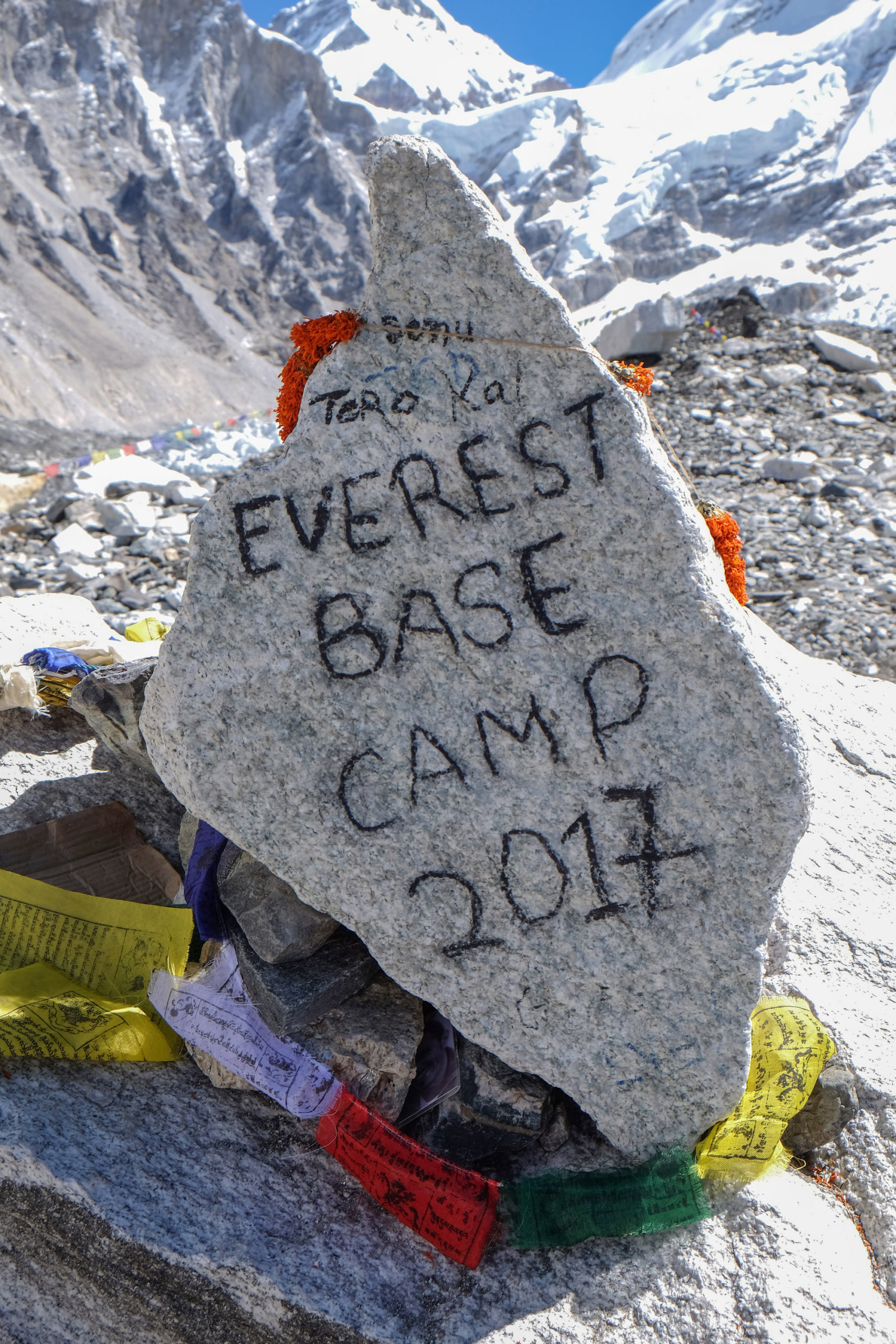
Today we are based at Gorak Shep but will make the trek from here to Everest Base Camp. This section of the trek begins on the flat sandy plateau to the north of Gorak Shep and the remainder is a draining scramble over rocks and boulders. The initial stages of the trek are cold and frosty, as the early morning sun hasn’t yet reached into the valley between the ranges of high peaks. During the two hour trek over glacial moraine we have good views of the peak of Everest (we still have not had a full view of the mountain as so far this has been hidden from view by other peaks). Finally, in spite of a number of the group feeling far from 100%, we complete the main objective of the Expedition and the group of fourteen all successfully reach Everest Base Camp (5356m the highest point of the trip so far). As the main climbing season is April and May, there are none of the familiar yellow tents of a base camp. However, the site is clearly marked by a number of memorial stones and endless prayer flags and there were many opportunities for the group to soak up the significance of the site, admire the Khumbu Icefield (the first challenge that any climber has to overcome while attempting to summit Everest) and take numerous photographs. Everest itself is not visible from base camp as it is blocked from view by the icefield and other peaks. With the main objective of the trip successfully completed we completed the long trek back to Gorak Shep.
Day 10 Kala Pattar, Gorak Shep to Pheriche
The summit of Kala Pattar (5545m), just to the north of Gorak Shep, is one of the best places to have the clearest views of Mount Everest. So at 4am this morning, seven of the team set off in the darkness (helped by the use of head torches) and freezing conditions to make the ‘lung busting’ trek to the summit. As we climbed, daylight slowly crept over the surrounding peaks, but the clouds kept Everest hidden from view. As we continued to climb, the morning winds blew the clouds around so we caught glimpses of each of the nearby peaks as we progressed. Two hours after setting off, and after a final 100m scramble over boulders, we finally had reached the summit of Kala Pattar. The sun had also risen high enough to be lighting up the 360 degree views of Himalayan peaks, including Pumori, Lobuche West, Lhotse and Nuptse. Finally, having remained hidden from view for so long, the full height and extent of Mount Everest became clear as the clouds cleared to reveal one of the most breathtaking sights on Earth. From here, you can see clearly from the Khumbu Icefield at the foot of the mountain, as well as the whole of the south face and, just below the summit, the famous Hillary Step. The group remained here for a short while to stare in awe at the incredible sight. Having enjoyed the amazing views, the descent from Kala Pattar took only 45 minutes!
Rejoining the rest of the team, the entire group set off from Gorak Shep to begin the several days descent back to our starting point at Lukla. As we followed the route we had taken only a few days before, the group made good time on the descent and we had reached Lobuche within an hour and a half. We continued to make good progress, and all were enjoying the extra levels of oxygen in the air as we lost all the altitude gained over the last few days. Pushing on, we continued across the glacial moraine to the Everest Memorial site, before descending to Dughla and dropping across the bridge that crosses the river flowing from the glacier. Rather than return towards Dingboche, we continued to drop towards the valley floor to follow the path of the river towards the town of Pheriche. Having dropped a significant altitude today (1500m for those who went to Kala Pattar and 1000m for the rest of the group), the extra oxygen in the air was noticeable and between this and a long day of trekking, everyone slept well tonight!
Day 11 Pheriche to Namche Bazaar
Today was to be another long day of trekking as the group were making good progress and those who had been suffering from the high altitude were beginning to feel more like themselves. Leaving Pheriche we dropped further down the valley to Orsho, then followed along the bank of the Imja Khola river. At this point of the trek, the scenery began to change noticeably as we finally reached the edge of the tree line. Continuing the trek, we reached the climb through the Rhododendron Forest to again arrive at Tengboche. Pausing only briefly to admire the monastery and the clear views, we began the long and winding descent to the valley floor below. After a short break, we began the arduous climb to the ridge above Phunki Thenga, which would lead us along the edge of the mountainside. Finally, after approximately 24km of trekking (not including height dropped and gained) we eventually reached Namche Bazaar for the second time on the trek.
Day 12 Namche Bazaar
As we were on ‘the way down’, there was no need for an acclimatisation day in Namche, so today truly was a ‘rest’ day in preparation for the final push at the end of the demanding trek. The group had time to sort out kit, wander round the local market (where traders had arrived with yak loads of produce to sell), to visit the Sherpa Museum and soak up the atmosphere in this colourful hillside town.
Day 13 Namche Bazaar to Lukla
Another demanding day lay ahead of the group today. The day started with the descent back down to Dudh Kosi – although all downhill, this section of the trek is neverending and the high impact takes a significant toll on the knees. Finally reaching the bottom of the valley and the river below, we made the return journey across the high wire suspension bridge. Although it should have been ‘downhill all the way’ from this point, the path that leads back to Phakding rises and falls through numerous villages and passes many waterfalls, and it seemed hard to believe that it had been almost two weeks since we had last trekked this route. After a short break in Phakding the good weather that we had enjoyed for the last few days disappeared and the rain began in earnest. Through the rain and the ever more slippery path we headed into the last section of the trek, climbing over 200m to finally round a corner through the cloud to the welcome sight of the Pasang Lhamo Memorial Gate (the first Nepali woman to summit Everest) as we arrived back into Lukla. The whole group felt a huge sense of achievement as we handed over our TIMS cards for the last time at the final checkpoint of the trek.
Day 14 Lukla to Kathmandu
This morning saw an early start at 04:30 to walk the ‘long’ trek from our hotel to the Tenzing-Hillary airport. Unfortunately, after raining all night, the sky was covered with thick clouds and we would have to sit it out in the airport in the hope the cloud would lift and that planes would be able to land at the airstrip. Delayed or cancelled flights are not uncommon at Lukla due to low cloud and poor visibility on the final approach to the short runway, and with a backlog of passengers whose flights had been cancelled the day before, there were a lot of bags and passengers eagerly watching the sky. After several hours at the airport, we returned to the lodge for lunch and remained on ‘standby’ there for the rest of the day. With no change in the cloud cover, there were no flights in or out of the airport today and we could only hope that the weather forecast for continuing cloud would be wrong.
Day 15 Lukla to Kathmandu
Throughout the night we had listened to torrential rain outside and it was with a sense of anxiety that we all opened the curtains this morning. In complete contrast to the previous morning, the sky was clear and the views were magnificent. So setting off again to the airport, we hoped that planes would soon start to arrive from Kathmandu to clear the scheduled flights and many trekkers like ourselves who had previously been delayed. After a short time, four flights arrived at the tiny airstrip within a few minutes of each other and started to clear the backlog of passengers. Watching the activity at this airport is fascinating and we even timed aircraft from the minute they touched down, taxied, off loaded one set of passengers and baggage, before reloading and returning to the runway – a rather impressive (if not unbelievable) total turn-around time of 4 minutes!!! After a short wait it was finally our turn to board our flight (a tiny Twin Otter aircraft) to return to Kathmandu. Sitting on the ‘top’ of the runway the pilot opened the throttle on the plane before dropping onto the short angled section of the runway (similar to a roller coaster drop), before taking off over a 700m drop into the valley at the end of the runway. The short flight saw us return to Kathmandu airport and a return to our base at British Gurhka Camp. The rest of the day was spent completing personal admin and sorting kit.
Activity and cultural days
Due to the unpredictable nature of flights in and out of Lukla, it is always recommended to allow a few contingency days at both the start and end of any trekking trip to Nepal. Therefore, having arrived back in Kathmandu, we had a number of days remaining in which to complete a number of other activities.
The whole group were able to continue with the adventure training theme by taking part in a day of white water rafting – this activity was both exhilarating and physically demanding and saw the group have to work as two teams to navigate our way over 30km of various grades of rapids.
Another day was spent visiting a number of Buddhist temples and religious sites to give us some more insight into the culture and religion of the country of Nepal.
Our final day in Kathmandu was spent trying to refine our haggling skills and buying the all important gifts and reminders of our trip to Nepal. These included outdoor gear, Kukhuri knives, cashmere wool items and paintings to name but a few.
Reflection
When the opportunity to take part in this Adventure Training expedition was presented to me, I grabbed the chance immediately as the trip combines two of my own past times, namely trekking and travel to other cultures. While I knew that the trip would be physically demanding (mainly due to the altitude and distances covered) I also knew that the scenery and the personal sense of achievement would be a fitting reward. Throughout the trip, the chance to work together as a team was presented to the group, and on occasions was tested to the extreme by the lack of oxygen and other effects of altitude. However, by working together as a team, the group were able to overcome these hardships and successfully reached Everest Base Camp together. For me personally, reaching Everest Base Camp and seeing sunrise over Mount Everest are the two most memorable moments of the trip and are memories that will last a long time. As with any travel, I enjoy learning about other cultures and this trip was no exception, and the sense of community amongst those who live and work in the mountains is to be admired.
I am acutely aware of the financial pressures that the Ministry Of Defence are under and without the support of the budgetary chain and the very generous support from all of the Non Public grant contributions (38 Irish Brigade, Reserve Forces and Cadets Association, Regimental Associations (Royal Irish Regiment Association, Royal Logistic Corps Association, Ulysses Trust and the Commanding Officer of the Northern Ireland Garrison Support Unit) then such an experience on an expedition like this, simply could not have happened.
Two final memorable phrases that I will now never forget:
“Attitude Over Altitude – get’s us to Everest Base camp”
“Go the extra mile to ensure success – it is never a crowded place”